For people who carve heightmaps / heightfields, are you using a pure grayscale image or an actual 3D model? If a pure grayscale image, how big are you images and what software do you use?
I currently use VCarve Pro for this type of work. Vectric’s legacy software PhotoVCarve - which is designed exactly for grayscale images - does not have many options for the actual machining work; it’s too primitive.
Unfortunately, the VCarve Pro requires a 3D model. I can produce this (from other software like 3dsmax or Blender), but the polygon resolution needed for a very detailed carving gets extreme, and the exported files are huge, even for small four inch actual carvings. If I want to carve a large image, say two or three feet, the polygon models would likely crash VCarve when importing them.
Using a pure grayscale image instead of a 3d model (which itself is simply generated from the grayscale image) would use fewer computer resources and user time. The image could get as big as 10,000 pixels in one direction.
Do I need to upgrade to Aspire?
Would Fusion work, and if so, would a pure grayscale image that is thousands of pixels in each dimension also crash Fusion when trying to make extremely detailed toolpaths?
I don’t know the best way to do this, as I haven’t done it, but I can give some advice on the software:
Aspire will have the same limitations; it just allows you to model stuff, but toolpaths/STL import are the same as VCarve.
I’d look more into Blender/3dsmax again, and not use as high a resolution as you have been; for CNC work, a lot of it may not matter. If you start to see tessellations/rectangles in your carved pieces, then you know you have to up the resolution a bit.
Fusion is worse at high-polygon mesh/STL imports (compared to vCarve).
Yeah fusion can get slow if you have a ridiculous number of mesh faces, and occasionally just decides to ignore meshes that it does not like. Sometimes importing a NURBS surface instead of a mesh can fix it ignoring geometry.
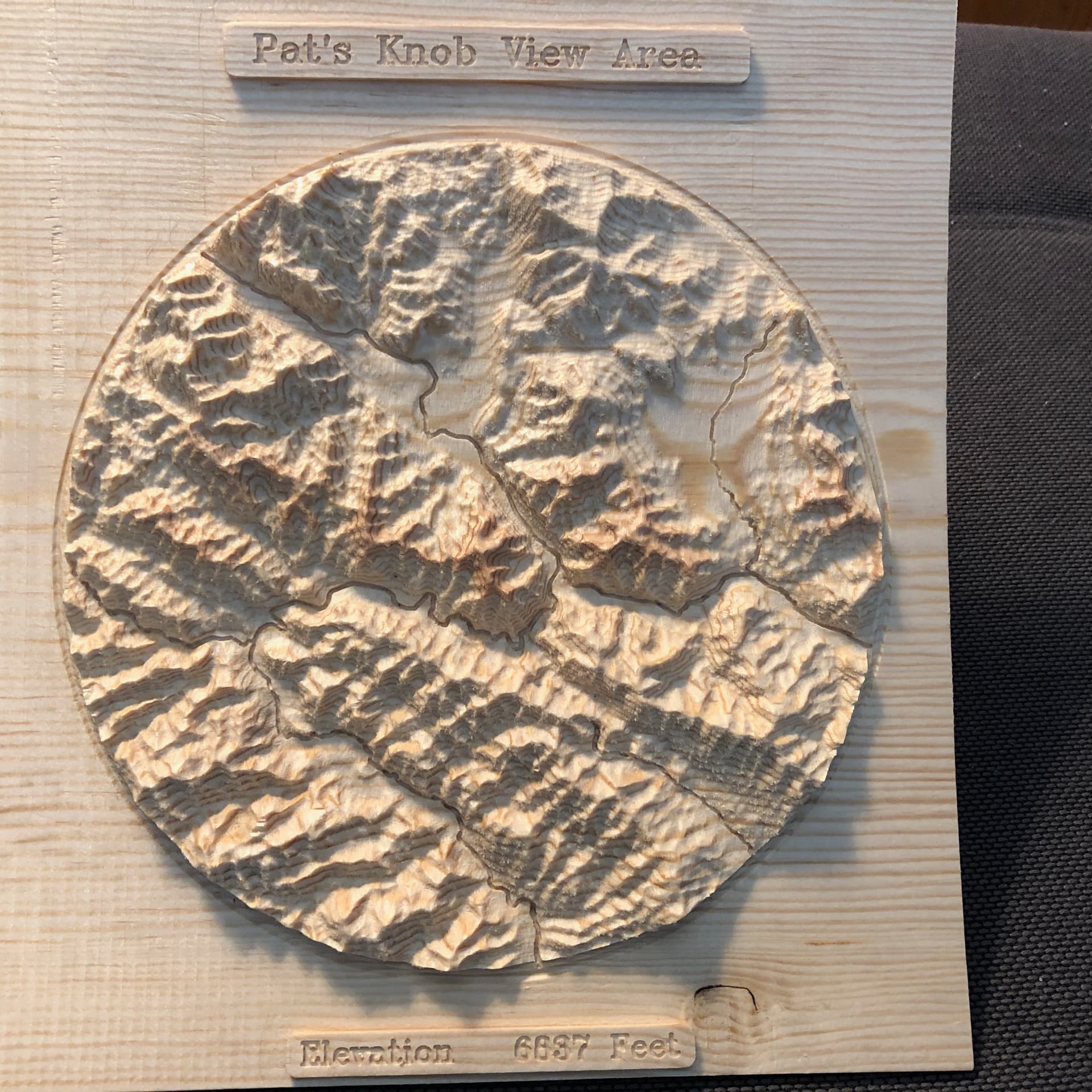
Start with a gray scale image, resolution depends on scale of carving, GOTOPO30 for large areas and STRM data for smaller areas. Data is usually from USGS
Import into QGIS then produce a virtual image file to get rid of lines between tiles
Use QGIS to clip the virtual image to a boundary, typically a state(s), county or polygon. I use the National Atlas data for clipping boundaries.
Produce a STL file using QGIS
Use VCarvePro to import STL file and produce the GCODE.
I have never had any problems with file size, some are over a million lines and run for hours. VCarvePro is a fabulous simulator.